| |
|
|
|
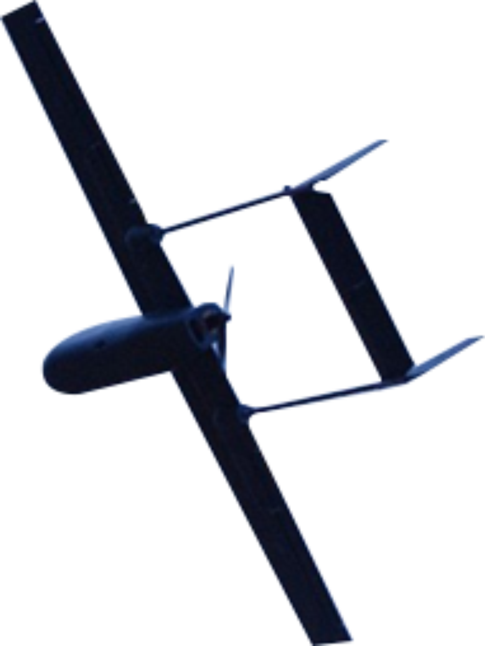
Surveyor-I Mini UAV
Surveyor-I is a fully autonomous Mini Unmanned Fixed Wing aircraft.
It is capable of carrying a 400 Gram payload and is ideally suited for surveying work.
The payload is a day still camera. Most high quality cameras are under 400 Grams.
The UAV is electrically power with a very low dB level.
The aircraft is autonomous right from Takeoff to Landing.
For ease of operation the aircraft is capable of hand launch and normal ground landing.
Catapult or arrester net is not required.
The UAV airframe is made of Elasto-Polymer foam and Carbon Fiber Composites.
|
|
| Physical Specifications: |
| |
Wing Span |
: |
1800mm |
| |
Length |
: |
1200mm |
| |
Height |
: |
150 mm |
| |
Flying Weight |
: |
2500gms |
| |
Payload |
: |
400 gms |
| |
Propulsion |
: |
350Watt BLDC Motors @11.1 Volt |
| |
Propeller |
: |
11x5 Fiber Reinforced Nylon |
| |
Flying Battery |
: |
Lithium-Ion 11.1 Volt, 13000mAh, Discharge @ 30A. |
|
| Flying Characteristics: |
| |
Range |
: |
10KM* |
| |
Endurance |
: |
100 Mins + 20 Mins reserve for failsafe |
| |
Accuracy |
: |
Within 10 meters of programmed waypoint |
| |
Cruise Speed |
: |
48 Km/Hr |
| |
Max Speed |
: |
60 Km/Hr |
| |
Stall Speed |
: |
35 Km/Hr |
| |
Max Winds |
: |
20 Km/Hr. |
| |
Altitude |
: |
3000 Meters |
| *Total Distance Traversed: 48Km |
|
|
| Capabilities: |
- Fully Autonomous from Takeoff to Landing.
- Can be programmed for 300 Waypoints/Mission Commands.
- Can ‘Loiter’ over the subject at any waypoint.
- Has Manual over ride at any stage.
- Can be ‘Guided’ to specific location during flight by clicking over map.
- Can activate/deactivate any payload from the GCS.
- Auto payload activation on reaching the waypoint.
- Failsafe built in.Will ‘RTL’ if link is lost. Will ‘Land’ if battery is low.
- GCS switchable navigation lights.
|
|
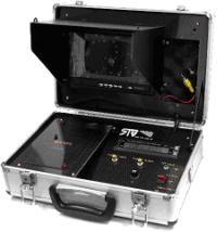
| Standard Package : |
- Surveyor Aircraft 1 Nos.
- GCS consisting of windows based palmtop.
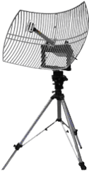
- Yagi Antenna for Data Link.
- Microprocessor based battery Charger.
- Radio Control Transmitter.
- Mini Tool Kit.
- Semi Ruggedized Carry Box.
|
|
| Auto Pilot: |
- Based on ARM Cortex M4 32 bit Processor @168 Mhz, running at 252 MIPS, RTOS.
- MPU-6000 Invensense 3-D Six Axis, Dual Gyro+Acc
- uBlox GPS with positioning from GPSS, GLONSS, Galelio, Biedu
- Secondary GPS for backup (optional)
- HMC5883L 3-Axis Dual Magnetometer
- MS5611 High Resolution Barometer
- Onboard Micro SD card for Flight Data Logging
|
|
| Data Link: |
| |
Output Power |
: |
500mW |
| |
Modulation Type |
: |
FHSS |
| |
Freq Band |
: |
900 Mhz (885-915 Mhz) |
| |
Range |
: |
10 Km (with Yagi antenna) |
|
| |
|
| |
| Radio Control Link: |
| |
Encoding |
: |
PPM |
| |
Modulation |
: |
FHSS |
| |
Freq Band |
: |
400-455 Mhz |
| |
Max RF Output |
: |
500 mW |
| |
Channels |
: |
8 |
| |
Range |
: |
5 Km when airborne |
| |
Display |
: |
Back-Lit LCD panel on Tx |
| |
Battery |
|
Li-Poly 11.1V, 2650 mAh (10 Hrs continuous operations). |
|
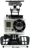
| Survey Camera: |
-
he aircraft is fitted with a CANON Powershot camera which takes still pictures at the grid waypoints
automatically. The pictures are then geo tagged using the telemetry log and then processed
on a stitching software like Pix4D to form a 3D map that can be used for engineering purpose.
|
|
|
|
|
|
|